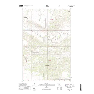
2020 Map of Lone Butte
USGS Topo · Published 2020About this map
Little Missouri National Grassland dominates this section of McKenzie County, where the dissected terrain of the North Dakota badlands meets the winding course of the Little Missouri River. In the northwest corner, a portion of Theodore Roosevelt National Park preserves the natural character of the landscape as it appeared before modern development. Notable topographical landmarks such as Morman Butte, Square Top, and Lone Butte rise above the drainage networks of Spring Cr, Rough Cr, and Dry Cr. This modern survey by the U.S. Geological Survey illustrates how rural infrastructure, including Long X Rd and Co RD 34, follows the natural contours of the land, providing access to these remote ranching and conservation areas while respecting the established township and range boundaries that have organized the region since its initial settlement.
Find a feature on this map
22 named features on this map. Tap any name to fly to it.
Don’t see what you’re looking for? This feature index may not catch every label — zoom into the map to look around manually.
Map Details
Editions of this 2020 Lone Butte Map
This is the sole edition of this map. No revisions or reprints were ever made.
Other maps of this area

1953 · Watford City
USGS Topo · 1:250,000

1957 · Watford City
USGS Topo · 1:250,000

1958 · Long X Divide
USGS Topo · 1:24,000

1958 · Lone Butte SE
USGS Topo · 1:24,000

1958 · Lone Butte
USGS Topo · 1:24,000

1958 · Tepee Buttes
USGS Topo · 1:24,000

1959 · Lone Butte NW
USGS Topo · 1:24,000

1959 · Lone Butte NE
USGS Topo · 1:24,000

1967 · Watford City
USGS Topo · 1:250,000

1974 · Petes Creek
USGS Topo · 1:24,000