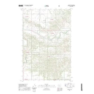
2023 Map of Lone Butte
USGS Topo · Published 2023About this map
Little Missouri National Grassland dominates this landscape in western North Dakota, where the winding path of the Little Missouri River carves through the terrain. The map captures a high-elevation environment defined by prominent landmarks such as Lone Butte in the southeast and Morman Butte to the north. A portion of the Theodore Roosevelt National Park is visible in the northwest corner, illustrating the protected status of these badlands. The drainage network is complex, with Rough Creek, Dry Creek, and Spring Creek all feeding toward the central river valley. Local infrastructure is sparse, primarily consisting of section-line roads like 125th Ave NW and rural routes such as Long X Rd, which provide access to the vast grazing lands and the isolated Square Top plateau.
Find a feature on this map
23 named features on this map. Tap any name to fly to it.
Don’t see what you’re looking for? This feature index may not catch every label — zoom into the map to look around manually.
Map Details
Editions of this 2023 Lone Butte Map
This is the sole edition of this map. No revisions or reprints were ever made.
Other maps of this area

1953 · Watford City
USGS Topo · 1:250,000

1957 · Watford City
USGS Topo · 1:250,000

1958 · Long X Divide
USGS Topo · 1:24,000

1958 · Lone Butte SE
USGS Topo · 1:24,000

1958 · Lone Butte
USGS Topo · 1:24,000

1958 · Tepee Buttes
USGS Topo · 1:24,000

1959 · Lone Butte NW
USGS Topo · 1:24,000

1959 · Lone Butte NE
USGS Topo · 1:24,000

1967 · Watford City
USGS Topo · 1:250,000

1974 · Petes Creek
USGS Topo · 1:24,000