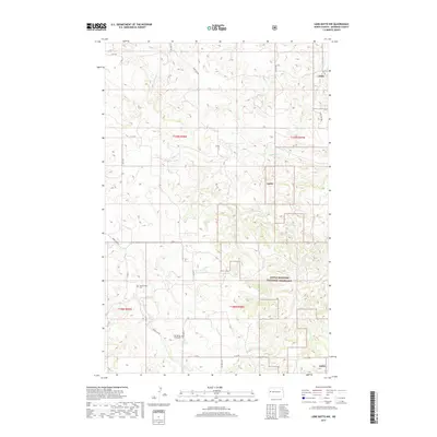
2017 Map of Lone Butte NW
USGS Topo · Published 2017About this map
Little Missouri National Grassland dominates this portion of McKenzie County, where the dissected prairie landscape is defined by a dense network of intermittent drainages. Waterways such as Sevenmile Creek and Elkhorn Creek carve through the terrain, illustrating the characteristic erosion patterns of the western North Dakota badlands. For genealogists and local historians, the map provides precise locations for the Spring Creek Cemetery and the Old Spring Creek Cemetery, both situated near the winding course of Spring Creek. The transport network consists primarily of section-line roads and rural routes like Spring Crk Rd and Co Rd 34, which connect isolated ranching and resource sites across the high plains. The transition between township boundaries, such as t149n r98w and t148n r98w, reveals the systematic grid of the Public Land Survey System overlaying this rugged natural topography.
Find a feature on this map
26 named features on this map. Tap any name to fly to it.
Don’t see what you’re looking for? This feature index may not catch every label — zoom into the map to look around manually.
Map Details
Editions of this 2017 Lone Butte NW Map
This is the sole edition of this map. No revisions or reprints were ever made.
Other maps of this area

1953 · Watford City
USGS Topo · 1:250,000

1957 · Watford City
USGS Topo · 1:250,000

1958 · Long X Divide
USGS Topo · 1:24,000

1958 · Lone Butte SE
USGS Topo · 1:24,000

1958 · Lone Butte
USGS Topo · 1:24,000

1958 · Tepee Buttes
USGS Topo · 1:24,000

1959 · Lone Butte NW
USGS Topo · 1:24,000

1959 · Lone Butte NE
USGS Topo · 1:24,000

1967 · Watford City
USGS Topo · 1:250,000

1978 · Schafer
USGS Topo · 1:24,000