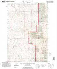
1997 Map of Lone Butte NW
USGS Topo · Published 2001About this map
Little Missouri National Grassland dominates the eastern portion of this landscape, where the rugged badlands of McKenzie County meet high prairie. Local social life in the mid-1990s is anchored by the Spring Creek Ch and its nearby Cem, along with the Elkhorn Sch located north of the E Kelly Ranch. The terrain is deeply incised by a drainage network including Sevenmile Creek, Elkhorn Creek, and Spring Creek, which provided essential water for early ranching operations. A lone Mine and various wells indicate the extraction history of the region. The map also records the Twelfth Standard Parallel North, a primary survey line that bisects the territory, reflecting the structured division of the Western frontier as it persisted into the modern era.
Find a feature on this map
19 named features on this map. Tap any name to fly to it.
Don’t see what you’re looking for? This feature index may not catch every label — zoom into the map to look around manually.
Map Details
Editions of this 1997 Lone Butte NW Map
This is the sole edition of this map. No revisions or reprints were ever made.
Other maps of this area

1953 · Watford City
USGS Topo · 1:250,000

1957 · Watford City
USGS Topo · 1:250,000

1958 · Long X Divide
USGS Topo · 1:24,000

1958 · Lone Butte SE
USGS Topo · 1:24,000

1958 · Lone Butte
USGS Topo · 1:24,000

1958 · Tepee Buttes
USGS Topo · 1:24,000

1959 · Lone Butte NW
USGS Topo · 1:24,000

1959 · Lone Butte NE
USGS Topo · 1:24,000

1967 · Watford City
USGS Topo · 1:250,000

1978 · Schafer
USGS Topo · 1:24,000