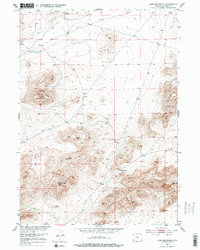
1951 Map of Lone Mountain
USGS Topo · Published 1978About this map
Lone Mountain dominates the central landscape of this 1951 survey, a prominent elevation in a terrain defined by ridges and drainages within the Missouri River Basin development area. To the south, Countryman Peak serves as another significant high point, overlooking the geographic transition toward Beef Gap. The presence of Sage Hen Springs and the headwaters of Sage Hen Creek in the northern reaches suggests the critical role of reliable water sources in this high-plains environment. This sheet is particularly useful for understanding the historic topographic layout before late-century changes, capturing the relationship between named landmarks like the interestingly titled Pocket Vice and the surrounding township boundaries. The map was produced through multiplex methods by Ryall Engineering Co., reflecting mid-century advancements in aerial photogrammetry for western land management.
Find a feature on this map
8 named features on this map. Tap any name to fly to it.
Don’t see what you’re looking for? This feature index may not catch every label — zoom into the map to look around manually.
Map Details
Editions of this 1951 Lone Mountain Map
3 editions found
Other maps of this area

1951 · Savage Peak
USGS Topo · 1:24,000

1951 · Bucklin Reservoirs
USGS Topo · 1:24,000

1951 · Lone Mountain
USGS Topo · 1:24,000

1951 · Split Rock
USGS Topo · 1:24,000

1951 · Lankin Dome
USGS Topo · 1:24,000

1952 · Mc Intosh Meadows
USGS Topo · 1:24,000

1955 · Casper
USGS Topo · 1:250,000

1958 · Casper
USGS Topo · 1:250,000

1959 · Miller Spring
USGS Topo · 1:24,000

1959 · Blackjack Ranch
USGS Topo · 1:24,000