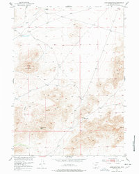
1951 Map of Lone Mountain
USGS Topo · Published 1978About this map
High-altitude desert terrain and isolated summits define this 1951 survey of the Missouri River Basin development area. Lone Mountain and Countryman Peak dominate the landscape, providing fixed points for surveyors navigating the complex topography of the Wyoming backcountry. The water network is sparse, centered on the drainage of Sage Hen Creek and the critical watering point at Sage Hen Springs in the northern portion of the quadrangle. A network of unimproved roads and trails connects distinct natural landforms like Vice Pocket and Beef Gap, illustrating how early ranching and mapping parties traversed this part of Natrona County before more modern infrastructure arrived. The map reflects a mid-century effort to document the remote interiors of the Western states for federal land and water management programs.
Find a feature on this map
10 named features on this map. Tap any name to fly to it.
Don’t see what you’re looking for? This feature index may not catch every label — zoom into the map to look around manually.
Map Details
Editions of this 1951 Lone Mountain Map
3 editions found
Other maps of this area

1951 · Savage Peak
USGS Topo · 1:24,000

1951 · Bucklin Reservoirs
USGS Topo · 1:24,000

1951 · Lone Mountain
USGS Topo · 1:24,000

1951 · Split Rock
USGS Topo · 1:24,000

1951 · Lankin Dome
USGS Topo · 1:24,000

1952 · Mc Intosh Meadows
USGS Topo · 1:24,000

1955 · Casper
USGS Topo · 1:250,000

1958 · Casper
USGS Topo · 1:250,000

1959 · Miller Spring
USGS Topo · 1:24,000

1959 · Blackjack Ranch
USGS Topo · 1:24,000