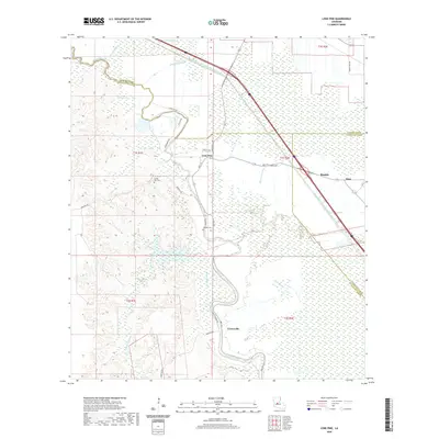
2020 Map of Lone Pine
USGS Topo · Published 2020About this map
Bayou Cocodrie winds through this central Louisiana landscape, marking a complex intersection of three parishes: Rapides, Evangeline, and Avoyelles. The settlement of Lone Pine serves as a central hub for local transit, where Cheneyville Rd and Rte 115 connect rural homesteads and agricultural tracts. This modern survey reflects the hydraulic engineering of the region, prominently featuring the Bayou Boeuf-Cocodrie Diversion Channel which cuts a straight line through the natural bayous and wetlands like Tiger Lake and Wilson Brake. To the southeast, the community of Centerville sits along the bayou's edge, while Griffin Hill Cem and Johnson Cem provide important reference points for genealogists tracking family heritage in these historic parish borderlands. The map also captures the periphery of larger settlements such as Bunkie and Haas at the eastern margin.
Find a feature on this map
35 named features on this map. Tap any name to fly to it.
Don’t see what you’re looking for? This feature index may not catch every label — zoom into the map to look around manually.
Map Details
Editions of this 2020 Lone Pine Map
This is the sole edition of this map. No revisions or reprints were ever made.
Other maps of this area

1935 · Turkey Creek
USGS Topo · 1:62,500

1935 · Lecompte
USGS Topo · 1:62,500

1940 · Marksville
USGS Topo · 1:62,500

1948 · Bunkie
USGS Topo · 1:62,500

1949 · Turkey Creek
USGS Topo · 1:62,500

1952 · Lake Charles
USGS Topo · 1:250,000

1953 · Alexandria
USGS Topo · 1:250,000

1954 · Lake Charles
USGS Topo · 1:250,000

1955 · Alexandria
USGS Topo · 1:250,000

1957 · Lecompte
USGS Topo · 1:62,500