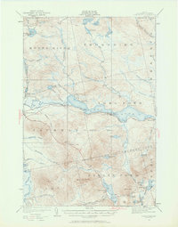
1922 Map of Long Pond
USGS Topo · Published 1962About this map
The Canadian Pacific railway cuts a distinct industrial line through this Somerset County landscape, connecting the timber-heavy region to broader markets. The local economy of the 1920s is anchored at Jackman Station and the nearby Jackman Mill, where the Moose River facilitates log transport and milling operations. North of the river, the township of Thorndike remains largely defined by its water bodies, including Fish Pond and Mud Pond, and the traces of the Alder Brook Trail.
Find a feature on this map
67 named features on this map. Tap any name to fly to it.
Don’t see what you’re looking for? This feature index may not catch every label — zoom into the map to look around manually.
Map Details
Editions of this 1922 Long Pond Map
5 editions found
Other maps of this area

1905 · The Forks
USGS Topo · 1:62,500

1907 · The Forks
USGS Topo · 1:62,500

1921 · Brassua Lake
USGS Topo · 1:62,500

1922 · Long Pond
USGS Topo · 1:62,500

1923 · Brassua Lake
USGS Topo · 1:62,500

1923 · Attean
USGS Topo · 1:62,500

1924 · Long Pond
USGS Topo · 1:62,500

1925 · Pierce Pond
USGS Topo · 1:48,000

1925 · Attean
USGS Topo · 1:62,500

1927 · Sandy Bay
USGS Topo · 1:48,000