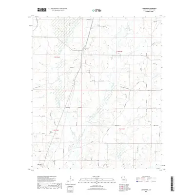
2018 Map of Longstreet
USGS Topo · Published 2018About this map
Longstreet and Funston sit at the heart of this DeSoto Parish landscape, where the terrain is defined by the winding paths of Bayou Castor and Bushneck Bayou. This region near the state line is characterized by a network of local roads and parish routes that connect dispersed rural homesites and family burial grounds. Notable landmarks include the Gamble Cem in the northeast and Mount Zion Cem to the southwest, serving as vital points for genealogical research. The southern portion of the sheet reaches the outskirts of Logansport, showing the transition from secluded bayou bottoms to more established transportation corridors. The map reflects a modern rural economy where timber and agriculture likely predominate, interwoven with a dense grid of named parish roads like Smyrna Rd and Wood Springs Rd.
Find a feature on this map
62 named features on this map. Tap any name to fly to it.
Don’t see what you’re looking for? This feature index may not catch every label — zoom into the map to look around manually.
Map Details
Editions of this 2018 Longstreet Map
This is the sole edition of this map. No revisions or reprints were ever made.
Other maps of this area

1944 · Logansport
USGS Topo · 1:62,500

1945 · Grand Cane
USGS Topo · 1:62,500

1945 · Socagee Bayou
USGS Topo · 1:62,500

1953 · Alexandria
USGS Topo · 1:250,000

1953 · Palestine
USGS Topo · 1:250,000

1955 · Shreveport
USGS Topo · 1:250,000

1955 · Alexandria
USGS Topo · 1:250,000

1956 · Shreveport
USGS Topo · 1:250,000

1956 · Tyler
USGS Topo · 1:250,000

1956 · Logansport
USGS Topo · 1:62,500