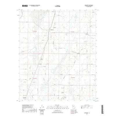
2020 Map of Longstreet
USGS Topo · Published 2020About this map
Longstreet and Funston serve as the primary hubs in this section of DeSoto Parish, where the landscape is defined by the winding paths of Bushneck Bayou, Bayou Castor, and Canadian Bayou. This rural area is characterized by a dense network of family and community landmarks, particularly evident in its numerous cemeteries and local congregations. Genealogists will find significant value in the distribution of burial sites, ranging from the central Longstreet Memorial Cem to smaller, family-oriented locations like the Ferguson Family Cem, Williams Family Cem, and Chreene Cem. Religious life is anchored by centers such as Smyrna Church and the Cornerstone Church. The map details the local infrastructure through roads like Wood Springs Rd and Parish Rd 92, illustrating a settlement pattern that remains closely tied to the region's natural waterways and long-standing family landholdings.
Find a feature on this map
70 named features on this map. Tap any name to fly to it.
Don’t see what you’re looking for? This feature index may not catch every label — zoom into the map to look around manually.
Map Details
Editions of this 2020 Longstreet Map
This is the sole edition of this map. No revisions or reprints were ever made.
Other maps of this area

1944 · Logansport
USGS Topo · 1:62,500

1945 · Grand Cane
USGS Topo · 1:62,500

1945 · Socagee Bayou
USGS Topo · 1:62,500

1953 · Alexandria
USGS Topo · 1:250,000

1953 · Palestine
USGS Topo · 1:250,000

1955 · Shreveport
USGS Topo · 1:250,000

1955 · Alexandria
USGS Topo · 1:250,000

1956 · Shreveport
USGS Topo · 1:250,000

1956 · Tyler
USGS Topo · 1:250,000

1956 · Logansport
USGS Topo · 1:62,500