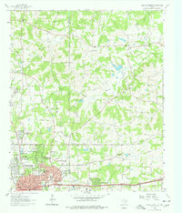
1962 Map of Longview Heights
USGS Topo · Published 1978About this map
The boundary between Gregg Co Harrison Co bisects this landscape during a period of industrial and residential expansion. The southern portion of the sheet is dominated by the growing footprint of Longview, characterized by new housing developments and civic institutions such as Forest Park Jr High Sch and Valley View Sch. The Texas and Pacific rail line runs parallel to Marshall Ave, anchoring the region's transportation network near East Side Airport.
Find a feature on this map
47 named features on this map. Tap any name to fly to it.
Don’t see what you’re looking for? This feature index may not catch every label — zoom into the map to look around manually.
Map Details
Editions of this 1962 Longview Heights Map
3 editions found
Other maps of this area

1936 · Kilgore
USGS Topo · 1:48,000

1940 · Kilgore
USGS Topo · 1:62,500

1956 · Tyler
USGS Topo · 1:250,000

1958 · Tatum
USGS Topo · 1:62,500

1960 · White Oak
USGS Topo · 1:24,000

1960 · Glenwood
USGS Topo · 1:24,000

1961 · Hallsville
USGS Topo · 1:24,000

1961 · Harleton
USGS Topo · 1:24,000

1962 · Ashland
USGS Topo · 1:24,000

1962 · Longview Heights
USGS Topo · 1:24,000