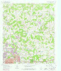
1962 Map of Longview Heights
USGS Topo · Published 1978About this map
Lansing and the expansion of the North Lansing Gas Field define the industrial character of this corner of East Texas as it transitioned from 1962 into the late 1970s. The landscape is a mosaic of energy infrastructure and rural tradition, where numerous pipelines intersect old community centers like Summerfield Ch and Hebron Ch. The boundary between Gregg and Harrison Counties bisects the sheet, with the growing residential grid of Longview and Longview Heights pushing into the wooded terrain. Significant genealogical detail is preserved in the location of several burial grounds, including Grace Hill Cemetery, Lily Hill Cem, and Hope Cem. Water features such as Whitehurst Lake and Little Lake punctuate the ridges, while the Texas & Pacific Railroad remains a primary transport artery near the south-central cluster of schools like Forest Hill Sch and Daniels Sch.
Find a feature on this map
51 named features on this map. Tap any name to fly to it.
Don’t see what you’re looking for? This feature index may not catch every label — zoom into the map to look around manually.
Map Details
Editions of this 1962 Longview Heights Map
3 editions found
Other maps of this area

1936 · Kilgore
USGS Topo · 1:48,000

1940 · Kilgore
USGS Topo · 1:62,500

1956 · Tyler
USGS Topo · 1:250,000

1958 · Tatum
USGS Topo · 1:62,500

1960 · White Oak
USGS Topo · 1:24,000

1960 · Glenwood
USGS Topo · 1:24,000

1961 · Hallsville
USGS Topo · 1:24,000

1961 · Harleton
USGS Topo · 1:24,000

1962 · Ashland
USGS Topo · 1:24,000

1962 · Longview Heights
USGS Topo · 1:24,000