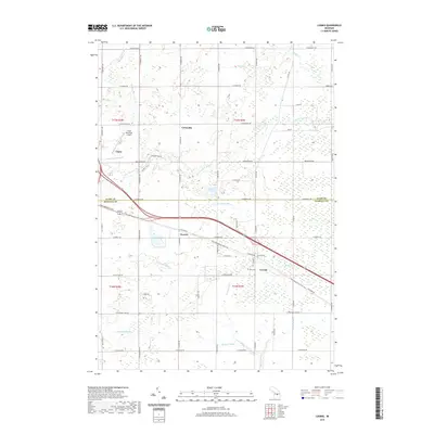
2019 Map of Loomis
USGS Topo · Published 2019About this map
Loomis and Herrick anchor the central landscape of this central Michigan study, where the boundary between Clare and Isabella Counties meets a sophisticated network of agricultural drainage. The S Br Tobacco River and the N Br Salt River define the local hydrology, supported by named channels like the Loomis Drain and Menery Drain. This modern record illustrates the transition from traditional rail corridors to recreational infrastructure, as the former railway is now preserved as the Pere Marquette State Trail, stretching across the quadrangle from Clare eastward through Loomis. Beyond the larger settlement of Clare, the map reveals more intimate local landmarks like the Wise Cem and Shively Lake, alongside the functional landscape of the Clare Municipal Airport.
Find a feature on this map
61 named features on this map. Tap any name to fly to it.
Don’t see what you’re looking for? This feature index may not catch every label — zoom into the map to look around manually.
Map Details
Editions of this 2019 Loomis Map
This is the sole edition of this map. No revisions or reprints were ever made.
Other maps of this area

1916 · Mount Pleasant
USGS Topo · 1:62,500

1919 · Mount Pleasant
USGS Topo · 1:62,500

1930 · Shepherd
USGS Topo · 1:48,000

1936 · Shepherd
USGS Topo · 1:62,500

1943 · Mount Pleasant
USGS Topo · 1:62,500

1954 · Midland
USGS Topo · 1:250,000

1958 · Midland
USGS Topo · 1:250,000

1959 · Midland
USGS Topo · 1:250,000

1959 · Clare
USGS Topo · 1:62,500

1966 · Midland
USGS Topo · 1:250,000