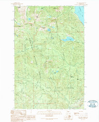
1989 Map of Lost Lake
USGS Topo · Published 1989About this map
Pacific Crest National Scenic Trail traverses the high ridges of the Cascades here, crossing the boundary between the Snoqualmie National Forest and Wenatchee National Forest. This 1989 survey details a complex hydrological landscape where the City of Seattle and City of Tacoma maintain critical water interests through the Cedar River Watershed and Green River Watershed. High mountain passes like Yakima Pass and Meadow Pass serve as natural transition points across the King and Kittitas County line.
Find a feature on this map
47 named features on this map. Tap any name to fly to it.
Don’t see what you’re looking for? This feature index may not catch every label — zoom into the map to look around manually.
Map Details
Editions of this 1989 Lost Lake Map
2 editions found
Other maps of this area

1901 · Snoqualmie Pass
USGS Topo · 1:125,000

1903 · Snoqualmie
USGS Topo · 1:125,000

1913 · Cedar Lake
USGS Topo · 1:125,000

1956 · Greenwater
USGS Topo · 1:62,500

1957 · Wenatchee
USGS Topo · 1:250,000

1960 · Bandera
USGS Topo · 1:62,500

1961 · Snoqualmie Pass
USGS Topo · 1:62,500

1962 · Lester
USGS Topo · 1:62,500

1975 · Snoqualmie Pass
USGS Topo · 1:100,000
1986 · Nagrom
USGS Topo · 1:24,000