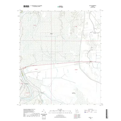
2020 Map of Lottie
USGS Topo · Published 2020About this map
The Atchafalaya River and its complex network of spillways define the landscape of this Louisiana interior, where the Morganza Floodway and Atchafalaya Basin Floodway serve as critical components of regional water management. Human settlement is concentrated along the higher ground of the eastern edge and the western riverbank. The community of Krotz Springs sits on the western shore of the river, while Lottie and Fordoche anchor the eastern drainage basin. This area is characterized by a dense system of bayous and sloughs, including Cottonwood Slough, Bayou White, and Alabama Bayou, which historically dictated the pattern of early roads and family landholdings. Local history is evidenced by features such as Cottonwood Cem near the intersection of Charles RD and Fordoche RD, and the path of Old Hwy 190 as it traverses the floodway between Sherburne and the eastern settlements.
Find a feature on this map
40 named features on this map. Tap any name to fly to it.
Don’t see what you’re looking for? This feature index may not catch every label — zoom into the map to look around manually.
Map Details
Editions of this 2020 Lottie Map
This is the sole edition of this map. No revisions or reprints were ever made.
Other maps of this area

1935 · Osca Bayou
USGS Topo · 1:62,500

1939 · Fordoche
USGS Topo · 1:62,500

1940 · Arnaudville
USGS Topo · 1:62,500

1953 · Maringouin
USGS Topo · 1:24,000

1954 · Fordoche
USGS Topo · 1:24,000

1954 · Baton Rouge
USGS Topo · 1:250,000

1955 · Osca Bayou
USGS Topo · 1:62,500

1955 · Fordoche
USGS Topo · 1:62,500

1956 · Baton Rouge
USGS Topo · 1:250,000
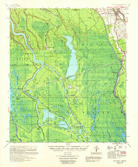
1959 · Osca Bayou
USGS Topo · 1:62,500