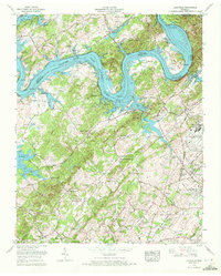
1968 Map of Louisville
USGS Topo · Published 1972About this map
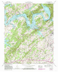
Fort Loudoun Lake dominates this landscape, winding through the valley where the Tennessee River meets the Blount and Knox county line. The 1968 revision captures the area’s post-war character, featuring the sprawl of Mc Ghee Tyson Air Force Base alongside older rural foundations. On the southern banks, Louisville appears as a central hub, flanked by the Louisville and Nashville RR and landmarks like Logan Hill.
Find a feature on this map
78 named features on this map. Tap any name to fly to it.
Don’t see what you’re looking for? This feature index may not catch every label — zoom into the map to look around manually.
Map Details
Editions of this 1968 Louisville Map
5 editions found
Other maps of this area

1886 · Knoxville
USGS Topo · 1:125,000

1892 · Knoxville
USGS Topo · 1:125,000

1894 · Knoxville
USGS Topo · 1:125,000

1895 · Loudon
USGS Topo · 1:125,000

1895 · Knoxville
USGS Topo · 1:125,000

1901 · Knoxville
USGS Topo · 1:125,000

1935 · Binfield
USGS Topo · 1:24,000

1935 · Knoxville
USGS Topo · 1:48,000

1935 · Meadow
USGS Topo · 1:24,000

1935 · Maryville
USGS Topo · 1:24,000