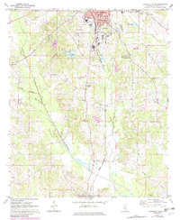
1972 Map of Louisville South
USGS Topo · Published 1982About this map
Louisville serves as the industrial and civic anchor of Winston County, shown here during a period of infrastructure expansion in the early 1970s and 1980s. The northern sector of the map detail includes the historic Courthouse, City Hall, and County Hospital, while the Illinois Central Gulf railroad line bisects the landscape, facilitating the movement of local timber and sand products from several Sandpits scattered across the terrain. To the south, the community transitions into a rural patchwork of small settlements and faith centers, including Center Ridge, Estes, and Macedonia.
Find a feature on this map
31 named features on this map. Tap any name to fly to it.
Don’t see what you’re looking for? This feature index may not catch every label — zoom into the map to look around manually.
Map Details
Editions of this 1972 Louisville South Map
2 editions found
Other maps of this area

1953 · Meridian
USGS Topo · 1:250,000

1953 · West Point
USGS Topo · 1:250,000

1957 · Meridian
USGS Topo · 1:250,000

1958 · West Point
USGS Topo · 1:250,000

1962 · Vernon
USGS Topo · 1:24,000

1963 · West Point
USGS Topo · 1:250,000

1965 · Meridian
USGS Topo · 1:250,000

1972 · Louisville North
USGS Topo · 1:24,000

1972 · Highpoint
USGS Topo · 1:24,000

1972 · Plattsburg
USGS Topo · 1:24,000