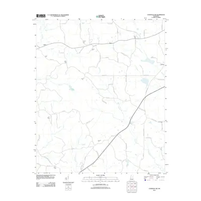
2012 Map of Louisville SW
USGS Topo · Published 2012About this map
Rome and Ford anchor this rural landscape in Winston County, where a network of winding creeks such as Lobutcha Cr and Noxapater Cr dictate the layout of timberlands and farm plots. The map reveals a deeply rooted community structure, evidenced by the high density of family and community burial grounds including Center Ridge Cem, Pleasant Hill Cem, and Shiloh Cem. These sites, often situated near minor road junctions like those at Dick Allen Rd or Walter Burroughs Rd, suggest the locations of early meeting houses and historical settlements. Water management and local recreation are visible at Kemps Pond, while the eastern edge is marked by the community of Calvary. The intricate web of named country lanes, such as Kerr-Adams-Mills Rd and Poppa McMillin Rd, provides an essential record for genealogists tracing ancestral property lines in this part of Mississippi.
Find a feature on this map
76 named features on this map. Tap any name to fly to it.
Don’t see what you’re looking for? This feature index may not catch every label — zoom into the map to look around manually.
Map Details
Editions of this 2012 Louisville SW Map
This is the sole edition of this map. No revisions or reprints were ever made.
Other maps of this area

1953 · Meridian
USGS Topo · 1:250,000

1953 · West Point
USGS Topo · 1:250,000

1957 · Meridian
USGS Topo · 1:250,000

1958 · West Point
USGS Topo · 1:250,000

1962 · Edinburg
USGS Topo · 1:62,500

1963 · West Point
USGS Topo · 1:250,000

1965 · Meridian
USGS Topo · 1:250,000

1972 · Louisville North
USGS Topo · 1:24,000

1972 · McCool
USGS Topo · 1:24,000

1972 · Highpoint
USGS Topo · 1:24,000