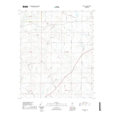
2020 Map of Louisville SW
USGS Topo · Published 2020About this map
Noxapater Cr winds through this rural landscape in Winston County, creating a network of drainage that includes Wildcat Cr, Ball Cr, and Tater Cr. This 2020 record of the area southwest of Louisville shows a community defined by its family-named roads and numerous small burial grounds. The map reveals the location of several significant sites for genealogists, including White Hall Cem and Pleasant Hill Cem in the north, and Mount Calvary Cem near the southern boundary. The presence of Center Ridge Cem and Little Calvary Cem suggests the historical importance of local church congregations in organizing this countryside. Movement through the area relies on a dense grid of secondary routes like Sam Ingram Rd and Hinze Rd, which connect the scattered homesteads and farming tracts across the Winston and Choctaw county line.
Find a feature on this map
73 named features on this map. Tap any name to fly to it.
Don’t see what you’re looking for? This feature index may not catch every label — zoom into the map to look around manually.
Map Details
Editions of this 2020 Louisville SW Map
This is the sole edition of this map. No revisions or reprints were ever made.
Other maps of this area

1953 · Meridian
USGS Topo · 1:250,000

1953 · West Point
USGS Topo · 1:250,000

1957 · Meridian
USGS Topo · 1:250,000

1958 · West Point
USGS Topo · 1:250,000

1962 · Edinburg
USGS Topo · 1:62,500

1963 · West Point
USGS Topo · 1:250,000

1965 · Meridian
USGS Topo · 1:250,000

1972 · Louisville North
USGS Topo · 1:24,000

1972 · McCool
USGS Topo · 1:24,000

1972 · Highpoint
USGS Topo · 1:24,000