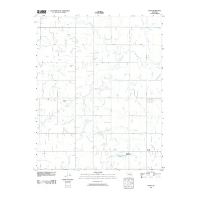
2009 Map of Lovell
USGS Topo · Published 2009About this map
Skeleton Creek and its many tributaries, including Cottonwood Creek and Spring Creek, define the drainage patterns of this rural Logan County landscape in the early 21st century. The map reveals a strictly gridded section-line road network, where local routes like n2970 RD and e0630 RD serve a series of farmsteads and agricultural plots. The topography is dotted with numerous small stock ponds, culminating in the Oknoname 083053 Reservoir and its associated Oknoname 083053 Dam in the southeast.
Find a feature on this map
32 named features on this map. Tap any name to fly to it.
Don’t see what you’re looking for? This feature index may not catch every label — zoom into the map to look around manually.
Map Details
Editions of this 2009 Lovell Map
This is the sole edition of this map. No revisions or reprints were ever made.
Other maps of this area

1892 · Kingfisher
USGS Topo · 1:125,000

1893 · Lovell
USGS Topo · 1:62,500

1893 · Hennessey
USGS Topo · 1:62,500

1895 · Kingfisher
USGS Topo · 1:125,000

1954 · Oklahoma City
USGS Topo · 1:250,000

1955 · Enid
USGS Topo · 1:250,000

1956 · Hennessey
USGS Topo · 1:62,500

1957 · Oklahoma City
USGS Topo · 1:250,000

1958 · Enid
USGS Topo · 1:250,000

1963 · Oklahoma City
USGS Topo · 1:250,000