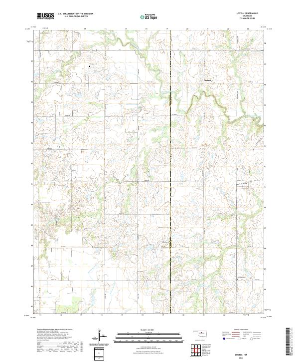
2022 Map of Lovell
USGS Topo · Published 2022About this map
Skeleton Creek and its many winding tributaries, including Cottonwood Cr and Lyon Cr, define the drainage patterns of this rural agricultural landscape straddling the border of Kingfisher and Logan Counties. The small settlements of Lovell and Roxana serve as the primary focal points of the township, which is gridded by an extensive network of county roads such as Co RD 62 and MacArthur Blvd. For those researching local family history, the map identifies the Sheridan Cem in the north and Oak View Cem near the southern boundary. The topography is marked by the distinct forks of the Oklahoma prairie, including W Fork Sooner Cr and E Fork Sooner Cr, showing the persistent rural character of the region in the early 21st century.
Find a feature on this map
37 named features on this map. Tap any name to fly to it.
Don’t see what you’re looking for? This feature index may not catch every label — zoom into the map to look around manually.
Map Details
Editions of this 2022 Lovell Map
This is the sole edition of this map. No revisions or reprints were ever made.
Other maps of this area

1892 · Kingfisher
USGS Topo · 1:125,000

1893 · Lovell
USGS Topo · 1:62,500

1893 · Hennessey
USGS Topo · 1:62,500

1895 · Kingfisher
USGS Topo · 1:125,000

1954 · Oklahoma City
USGS Topo · 1:250,000

1955 · Enid
USGS Topo · 1:250,000

1956 · Hennessey
USGS Topo · 1:62,500

1957 · Oklahoma City
USGS Topo · 1:250,000

1958 · Enid
USGS Topo · 1:250,000

1963 · Oklahoma City
USGS Topo · 1:250,000