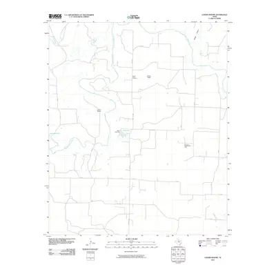
2010 Map of Lovers Resort
USGS Topo · Published 2010About this map
Brazos Valley and the Salt Fork Brazos River anchor this central Texas landscape, characterized by winding watercourses and distinct topographical elevations. The settlement of Lovers Resort occupies a central position near the river's path, while the Brazos Valley Cemetery provides a focal point for local genealogical interest. The terrain is marked by the Salt Croton Hills to the northwest and Bridge Canyon in the northeast, illustrating the drainage patterns of Salt Croton Creek and its tributaries.
Find a feature on this map
23 named features on this map. Tap any name to fly to it.
Don’t see what you’re looking for? This feature index may not catch every label — zoom into the map to look around manually.
Map Details
Editions of this 2010 Lovers Resort Map
This is the sole edition of this map. No revisions or reprints were ever made.
Other maps of this area

1931 · Aspermont
USGS Topo · 1:62,500

1954 · Lubbock
USGS Topo · 1:250,000

1958 · Southerland Canyon
USGS Topo · 1:24,000

1958 · Seven Diamond L Canyon
USGS Topo · 1:24,000

1958 · Lovers Resort
USGS Topo · 1:24,000

1959 · Bob Creek
USGS Topo · 1:24,000

1967 · Kiowa Peak NW
USGS Topo · 1:24,000

1967 · Kiowa Peak SW
USGS Topo · 1:24,000
1968 · Aspermont
USGS Topo · 1:24,000

1968 · Peacock
USGS Topo · 1:24,000