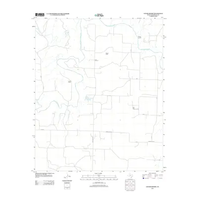
2012 Map of Lovers Resort
USGS Topo · Published 2012About this map
The Salt Fork Brazos River winds through the heart of this Stonewall County landscape, shaping a terrain defined by breaks and canyons. Near its banks, the small settlement of Lovers Resort and the community of Brazos Valley sit amidst a network of county roads. The importance of local hydrology is evident in the presence of Salt Croton Falls and various drainages like Salt Croton Cr and Bridge Canyon.
Find a feature on this map
22 named features on this map. Tap any name to fly to it.
Don’t see what you’re looking for? This feature index may not catch every label — zoom into the map to look around manually.
Map Details
Editions of this 2012 Lovers Resort Map
This is the sole edition of this map. No revisions or reprints were ever made.
Other maps of this area

1931 · Aspermont
USGS Topo · 1:62,500

1954 · Lubbock
USGS Topo · 1:250,000

1958 · Southerland Canyon
USGS Topo · 1:24,000

1958 · Seven Diamond L Canyon
USGS Topo · 1:24,000

1958 · Lovers Resort
USGS Topo · 1:24,000

1959 · Bob Creek
USGS Topo · 1:24,000

1967 · Kiowa Peak NW
USGS Topo · 1:24,000

1967 · Kiowa Peak SW
USGS Topo · 1:24,000
1968 · Aspermont
USGS Topo · 1:24,000

1968 · Peacock
USGS Topo · 1:24,000