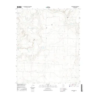
2016 Map of Lovers Resort
USGS Topo · Published 2016About this map
Salt Fork Brazos River winds through the central portion of this map, creating a complex drainage network in the heart of Stonewall County. This 2016 survey documents the rural character of the area surrounding Lovers Resort and Brazos Valley, where the landscape is defined by deep cuts like Pitchfork Canyon and Bridge Canyon. The presence of the Brazos Valley Cem provides a focal point for family history research in this lightly populated region. Transport in the area relies on a grid of county roads and FM 1646, connecting isolated water features such as Salt Croton Falls and Landreth Lake. The map illustrates how local topography and water access dictated the placement of small ranching-era settlements and individual property improvements across the Texas plains.
Find a feature on this map
21 named features on this map. Tap any name to fly to it.
Don’t see what you’re looking for? This feature index may not catch every label — zoom into the map to look around manually.
Map Details
Editions of this 2016 Lovers Resort Map
This is the sole edition of this map. No revisions or reprints were ever made.
Other maps of this area

1931 · Aspermont
USGS Topo · 1:62,500

1954 · Lubbock
USGS Topo · 1:250,000

1958 · Southerland Canyon
USGS Topo · 1:24,000

1958 · Seven Diamond L Canyon
USGS Topo · 1:24,000

1958 · Lovers Resort
USGS Topo · 1:24,000

1959 · Bob Creek
USGS Topo · 1:24,000

1967 · Kiowa Peak NW
USGS Topo · 1:24,000

1967 · Kiowa Peak SW
USGS Topo · 1:24,000
1968 · Aspermont
USGS Topo · 1:24,000

1968 · Peacock
USGS Topo · 1:24,000