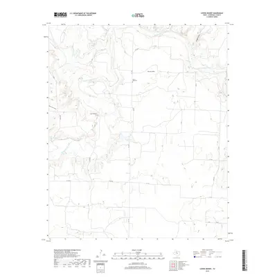
2019 Map of Lovers Resort
USGS Topo · Published 2019About this map
The Salt Fork Brazos River carves a complex, winding path through this portion of Stonewall County, joined by the waters of Salt Croton Cr. The terrain is defined by dramatic erosional features like Bridge Canyon and North Camp Hollow, which contrast with the flatter uplands dedicated to rural ranching and access roads. The settlement of Lovers Resort and the community of Brazos Valley represent the primary human footprints in this arid landscape. Genealogists will find the Brazos Valley Cem centrally located near FM 1646, serving as a vital record for the area's local history. Small bodies of water, including Duda Lake and Landreth Lake, provide essential water sources in a region dominated by the river’s deep drainage system.
Find a feature on this map
20 named features on this map. Tap any name to fly to it.
Don’t see what you’re looking for? This feature index may not catch every label — zoom into the map to look around manually.
Map Details
Editions of this 2019 Lovers Resort Map
This is the sole edition of this map. No revisions or reprints were ever made.
Other maps of this area

1931 · Aspermont
USGS Topo · 1:62,500

1954 · Lubbock
USGS Topo · 1:250,000

1958 · Southerland Canyon
USGS Topo · 1:24,000

1958 · Seven Diamond L Canyon
USGS Topo · 1:24,000

1958 · Lovers Resort
USGS Topo · 1:24,000

1959 · Bob Creek
USGS Topo · 1:24,000

1967 · Kiowa Peak NW
USGS Topo · 1:24,000

1967 · Kiowa Peak SW
USGS Topo · 1:24,000
1968 · Aspermont
USGS Topo · 1:24,000

1968 · Peacock
USGS Topo · 1:24,000