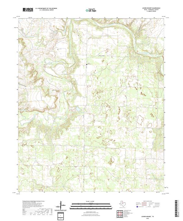
2022 Map of Lovers Resort
USGS Topo · Published 2022About this map
The Salt Fork Brazos River winds through this section of Stonewall County, creating a landscape defined by deep draws and significant riparian features. This 2022 survey captures the sparse ranching and agricultural character of the region, anchored by the settlement of Brazos Valley and the smaller Lovers Resort. To the north, the terrain drops off at Salt Croton Falls as Salt Croton Cr joins the larger river system. The presence of Brazos Valley Cem provides a focal point for family researchers, while landforms like Bridge Canyon and North Camp Hollow indicate the varied topography of the West Texas plains. Local water sources including Duda Lake and Landreth Lake serve as vital landmarks in this arid environment, connected by a network of farm roads and county routes such as FM 1646 and Co RD 328.
Find a feature on this map
22 named features on this map. Tap any name to fly to it.
Don’t see what you’re looking for? This feature index may not catch every label — zoom into the map to look around manually.
Map Details
Editions of this 2022 Lovers Resort Map
This is the sole edition of this map. No revisions or reprints were ever made.
Other maps of this area

1931 · Aspermont
USGS Topo · 1:62,500

1954 · Lubbock
USGS Topo · 1:250,000

1958 · Southerland Canyon
USGS Topo · 1:24,000

1958 · Seven Diamond L Canyon
USGS Topo · 1:24,000

1958 · Lovers Resort
USGS Topo · 1:24,000

1959 · Bob Creek
USGS Topo · 1:24,000

1967 · Kiowa Peak NW
USGS Topo · 1:24,000

1967 · Kiowa Peak SW
USGS Topo · 1:24,000
1968 · Aspermont
USGS Topo · 1:24,000

1968 · Peacock
USGS Topo · 1:24,000