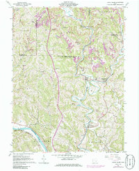
1961 Map of Lower Salem
USGS Topo · Published 1986About this map
Lower Salem and its surrounding hill country in Washington and Noble counties are defined by the winding course of Duck Creek and its many forks. This area, documented in the early 1960s with revisions in the 1970s, shows a landscape of small agricultural settlements and rural industry, where numerous strip mines dot the ridges above the valley floors. Transportation is anchored by the Penn Central and Baltimore and Ohio railroads, which follow the natural contours of the Muskingum River and the West Fork of Duck Creek. Local history is deeply embedded in the terrain through family and community landmarks such as Shafers Ch, Good Hope Cem, and the Salem-Liberty Sch, reflecting a legacy of dispersed settlement and local education in this corner of southeastern Ohio.
Find a feature on this map
43 named features on this map. Tap any name to fly to it.
Don’t see what you’re looking for? This feature index may not catch every label — zoom into the map to look around manually.
Map Details
Editions of this 1961 Lower Salem Map
3 editions found
Other maps of this area

1902 · Parkersburg
USGS Topo · 1:62,500

1903 · Macksburg
USGS Topo · 1:62,500

1904 · Parkersburg
USGS Topo · 1:62,500

1904 · Marietta
USGS Topo · 1:62,500

1905 · Macksburg
USGS Topo · 1:62,500

1909 · Caldwell
USGS Topo · 1:62,500

1912 · Caldwell
USGS Topo · 1:62,500

1924 · Marietta
USGS Topo · 1:62,500

1927 · Marietta
USGS Topo · 1:62,500

1949 · Clarksburg
USGS Topo · 1:250,000