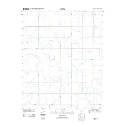
2012 Map of Loyal SE
USGS Topo · Published 2012About this map
Alpha sits at the northern edge of this agricultural landscape in Kingfisher County, which is defined by a grid of rural section roads and the meandering courses of local waterways. The terrain is drained by Kingfisher Cr and its tributaries, including Winter Camp Cr, which winds through the southern and central portions of the survey area. For those researching local heritage, the map identifies two distinct burial grounds: Indian Cem in the west and Mt Pisgah Cem near the southern boundary. The 2012 road network, comprised of numbered routes like e0820 RD and n2770 RD, illustrates the modern connectivity of this prairie region, preserving the traditional layout of Oklahoma's land runs while documenting the contemporary water and transit infrastructure.
Find a feature on this map
21 named features on this map. Tap any name to fly to it.
Don’t see what you’re looking for? This feature index may not catch every label — zoom into the map to look around manually.
Map Details
Editions of this 2012 Loyal SE Map
This is the sole edition of this map. No revisions or reprints were ever made.
Other maps of this area

1892 · Kingfisher
USGS Topo · 1:125,000

1893 · Fort Reno
USGS Topo · 1:62,500

1893 · Loyal
USGS Topo · 1:62,500

1895 · Kingfisher
USGS Topo · 1:125,000

1941 · Fort Reno
USGS Topo · 1:62,500

1942 · Fort Reno
USGS Topo · 1:62,500

1949 · Fort Reno
USGS Topo · 1:62,500

1954 · Oklahoma City
USGS Topo · 1:250,000

1955 · Clinton
USGS Topo · 1:250,000

1957 · Clinton
USGS Topo · 1:250,000