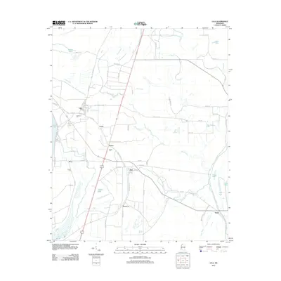
2012 Map of Lula
USGS Topo · Published 2012About this map
Lula anchors the northern portion of this Delta survey, where a grid of streets including 1st St and Perryman St meets the Lula Highway 61 Rd N. The landscape is defined by its complex hydrology, dominated by the Yazoo Pass and the Coldwater River. These waterways, alongside oxbows like Moon Lake and Haynes Lake, dictated the settlement patterns of agricultural hamlets such as Barbee, Carter, and Roseacres. Genealogists will find several burial sites preserved in the record, including Bethlehem Cem, Barbee Cem, and Walton Cem. The concentration of named bayous, from Phillips Bayou to Broad Bayou, illustrates the persistent challenge of drainage in this alluvial plain. Small clusters of development at Rich and Birdie highlight the early 21st-century footprint of these rural Mississippi communities.
Find a feature on this map
78 named features on this map. Tap any name to fly to it.
Don’t see what you’re looking for? This feature index may not catch every label — zoom into the map to look around manually.
Map Details
Editions of this 2012 Lula Map
This is the sole edition of this map. No revisions or reprints were ever made.
Other maps of this area

1908 · Lula
USGS Topo · 1:24,000

1908 · Dundee
USGS Topo · 1:24,000

1908 · Coahoma
USGS Topo · 1:24,000

1908 · Moon Lake
USGS Topo · 1:24,000

1908 · Jonestown
USGS Topo · 1:24,000

1908 · Walnut Lake
USGS Topo · 1:24,000

1910 · Dundee
USGS Topo · 1:31,680

1910 · Coahoma
USGS Topo · 1:31,680

1910 · Walnut Lake
USGS Topo · 1:31,680

1910 · Jonestown
USGS Topo · 1:31,680