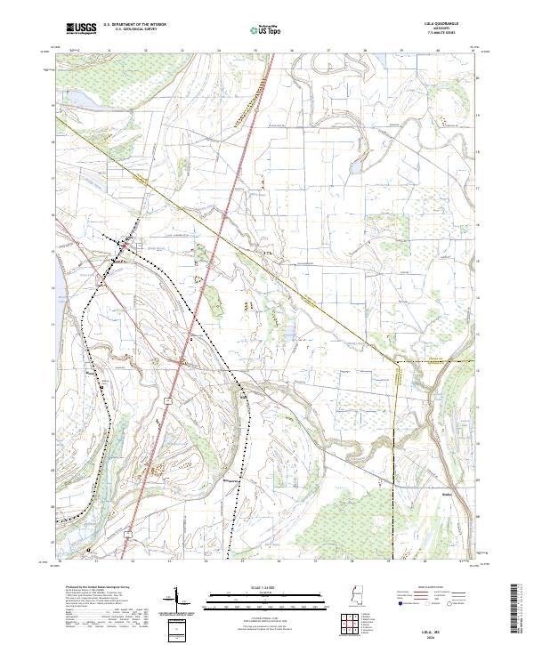
2024 Map of Lula
USGS Topo · Published 2024About this map
Lula serves as a central point in this Delta landscape, where the confluence of agriculture and water has long defined Coahoma County. The town is flanked by the broad expanse of Moon Lake and the complex drainage systems of Brady Bayou and Muddy Bayou. Notable for genealogists are several rural burial grounds including Bethlehem Cem, Barbee Cem, and Hull Cem, which anchor the histories of local families in the surrounding fields. The historical significance of the Yazoo Pass is evident here, marking a traditional waterway through the alluvial plain toward the Coldwater River. Scattered settlements like Rich, Roseacres, and Birdie are linked by a network of rural roads such as Lula Rich Rd and Birdie Rd, reflecting a land use pattern established by generations of cotton farming and river navigation near the Tunica and Quitman county lines.
Find a feature on this map
74 named features on this map. Tap any name to fly to it.
Don’t see what you’re looking for? This feature index may not catch every label — zoom into the map to look around manually.
Map Details
Editions of this 2024 Lula Map
This is the sole edition of this map. No revisions or reprints were ever made.
Other maps of this area

1908 · Lula
USGS Topo · 1:24,000

1908 · Dundee
USGS Topo · 1:24,000

1908 · Coahoma
USGS Topo · 1:24,000

1908 · Moon Lake
USGS Topo · 1:24,000

1908 · Jonestown
USGS Topo · 1:24,000

1908 · Walnut Lake
USGS Topo · 1:24,000

1910 · Dundee
USGS Topo · 1:31,680

1910 · Coahoma
USGS Topo · 1:31,680

1910 · Walnut Lake
USGS Topo · 1:31,680

1910 · Jonestown
USGS Topo · 1:31,680