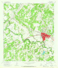
1964 Map of Luling
USGS Topo · Published 1966About this map
Luling serves as the focal point for this mid-1960s survey of the intersection between the San Marcos River and the regional petroleum industry. The landscape is heavily marked by the Speller Oil Field and Dunlap Oil Field, where numerous oil wells and pipelines are interspersed with agricultural features like the Ussery Cem and the Rosenwald Sch. This era captures the town's established infrastructure, including the Luling Memorial Airfield and the Southern Pacific railroad line, which cuts through the heart of the settlement.
Find a feature on this map
45 named features on this map. Tap any name to fly to it.
Don’t see what you’re looking for? This feature index may not catch every label — zoom into the map to look around manually.
Map Details
Editions of this 1964 Luling Map
3 editions found
Other maps of this area

1911 · San Marcos
USGS Topo · 1:125,000

1919 · San Marcos
USGS Topo · 1:125,000

1924 · San Marcos 3-d
USGS Topo · 1:48,000

1925 · San Marcos 4-c
USGS Topo · 1:48,000

1925 · San Marcos 1-d
USGS Topo · 1:48,000

1925 · San Marcos 4-a
USGS Topo · 1:48,000

1929 · Luling
USGS Topo · 1:62,500

1930 · Lockhart
USGS Topo · 1:62,500

1930 · Seguin
USGS Topo · 1:62,500

1953 · Seguin
USGS Topo · 1:250,000