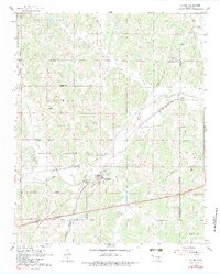
1966 Map of Luther
USGS Topo · Published 1983About this map
The town of Luther serves as the central hub of this mid-1960s landscape, positioned where the St Louis - San Francisco railroad and Wildhorse Creek meet. This era is defined by a dense concentration of petroleum extraction, with extensive drilling operations marked across the Luther Gas and Oil Field and the West Luther Oil and Gas Field. The transport network shows a transition in progress, featuring the established Missouri - Kansas - Texas rail line alongside the modern Turner Toll road. Genealogists can locate several burial sites surrounding the community, including Luther Cem, St Luke Cem, and the Reunion Cem to the northwest. The terrain is deeply influenced by the winding course of the Deep Fork, which dictates the movement of both local roads and historical property boundaries across the Oklahoma and Lincoln county lines.
Find a feature on this map
37 named features on this map. Tap any name to fly to it.
Don’t see what you’re looking for? This feature index may not catch every label — zoom into the map to look around manually.
Map Details
Editions of this 1966 Luther Map
3 editions found
Other maps of this area

1892 · Guthrie
USGS Topo · 1:62,500

1892 · Edmond
USGS Topo · 1:62,500

1909 · Luther
USGS Topo · 1:62,500

1909 · Perkins
USGS Topo · 1:62,500

1935 · Edmond
USGS Topo · 1:48,000

1940 · Edmond
USGS Topo · 1:62,500

1954 · Oklahoma City
USGS Topo · 1:250,000
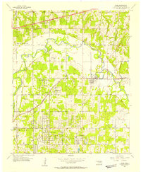
1955 · Jones
USGS Topo · 1:24,000

1956 · Horseshoe Lake
USGS Topo · 1:24,000

1957 · Oklahoma City
USGS Topo · 1:250,000