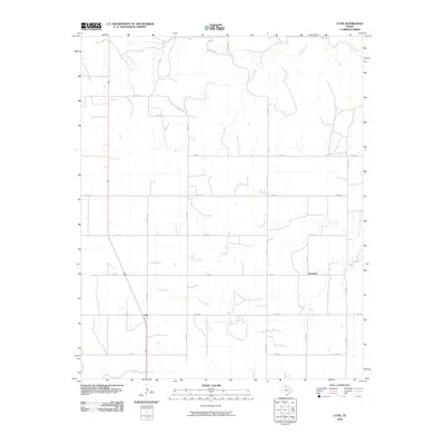
2010 Map of Lutie
USGS Topo · Published 2010About this map
Lutie and Aberdeen serve as the primary focal points of this Collingsworth County landscape, situated at the intersection of a sprawling rural road network and natural watercourses. The terrain is defined by the winding paths of Wolf Creek in the south and Elm Creek and Corral Creek to the north, which carve through the plains. The geometric precision of the county road system, including Co RD 190 and Co RD 210, illustrates the enduring structure of Texas Panhandle ranching and farming divisions. This 2010 survey by the U.S. Geological Survey captures the area's infrastructure, from state-maintained Farm to Market Roads like Fm 1439 to the numerous local routes that connect isolated homesteads and agricultural operations across the quadrangle.
Find a feature on this map
21 named features on this map. Tap any name to fly to it.
Don’t see what you’re looking for? This feature index may not catch every label — zoom into the map to look around manually.
Map Details
Editions of this 2010 Lutie Map
This is the sole edition of this map. No revisions or reprints were ever made.
Other maps of this area

1954 · Amarillo
USGS Topo · 1:250,000

1954 · Plainview
USGS Topo · 1:250,000

1958 · Amarillo
USGS Topo · 1:250,000

1958 · Plainview
USGS Topo · 1:250,000

1959 · Wellington NW
USGS Topo · 1:24,000

1959 · Shinnery Creek
USGS Topo · 1:24,000

1963 · Fulller
USGS Topo · 1:24,000

1963 · Shamrock East
USGS Topo · 1:24,000

1963 · Shamrock West
USGS Topo · 1:24,000

1963 · Little Wolf Creek
USGS Topo · 1:24,000