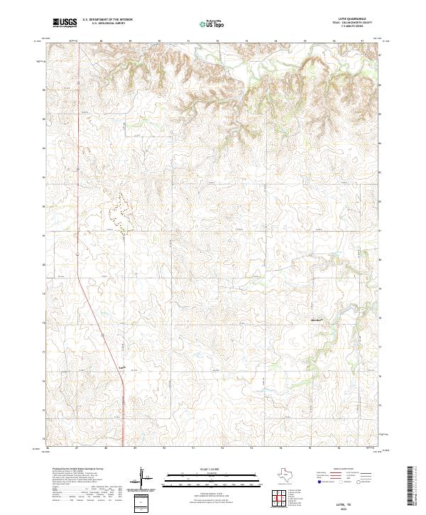
2022 Map of Lutie
USGS Topo · Published 2022About this map
Lutie and Aberdeen serve as the primary focal points of this portion of Collingsworth County, where the landscape is defined by the dendritic drainage patterns of the Red River watershed. The area is characterized by a network of intermittent streams and springs, most notably Wolf Creek Springs which feeds into the larger Wolf Creek. This transition from the High Plains into the rolling breaks of North Texas is evidenced by the numerous named drainages like Elm Cr, Corral Cr, and Indian Cr. The human imprint on the land follows a rigid section-line grid of rural routes, including FM 1439 and FM 1036, which intersect at these small agricultural hubs. This modern survey illustrates how local transportation and small-scale ranching continue to rely on the natural geography established by these seasonal waterways.
Find a feature on this map
20 named features on this map. Tap any name to fly to it.
Don’t see what you’re looking for? This feature index may not catch every label — zoom into the map to look around manually.
Map Details
Editions of this 2022 Lutie Map
This is the sole edition of this map. No revisions or reprints were ever made.
Other maps of this area

1954 · Amarillo
USGS Topo · 1:250,000

1954 · Plainview
USGS Topo · 1:250,000

1958 · Amarillo
USGS Topo · 1:250,000

1958 · Plainview
USGS Topo · 1:250,000

1959 · Wellington NW
USGS Topo · 1:24,000

1959 · Shinnery Creek
USGS Topo · 1:24,000

1963 · Fulller
USGS Topo · 1:24,000

1963 · Shamrock East
USGS Topo · 1:24,000

1963 · Shamrock West
USGS Topo · 1:24,000

1963 · Little Wolf Creek
USGS Topo · 1:24,000