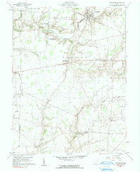
1960 Map of Lynchburg
USGS Topo · Published 1990About this map
The Baltimore and Ohio Railroad cuts through the northern reaches of Highland County, anchoring the village of Lynchburg where the track crosses Turtle Creek. This area of the Virginia Military District is characterized by a dense network of family-named cemeteries and small crossroads settlements that define the rural social landscape of the mid-20th century. Local landmarks like Pricetown Sch and Salem Ch serve as centers for the surrounding farming community near Pricetown.
Find a feature on this map
58 named features on this map. Tap any name to fly to it.
Don’t see what you’re looking for? This feature index may not catch every label — zoom into the map to look around manually.
Map Details
Editions of this 1960 Lynchburg Map
3 editions found
Other maps of this area

1907 · Blanchester
USGS Topo · 1:62,500

1917 · Hillsboro
USGS Topo · 1:62,500

1917 · Sabina
USGS Topo · 1:62,500

1917 · Sardinia
USGS Topo · 1:62,500

1943 · Sabina
USGS Topo · 1:62,500

1944 · Hillsboro
USGS Topo · 1:62,500

1944 · Sardinia
USGS Topo · 1:62,500

1947 · Columbus
USGS Topo · 1:250,000
1960 · Lynchburg
USGS Topo · 1:24,000

1960 · Martinsville
USGS Topo · 1:24,000