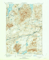
1911 Map of Lyon Mountain
USGS Topo · Published 1963About this map
Lyon Mountain dominates the landscape of this 1911 survey, serving as a high-altitude anchor for the industrial and rural settlements of the northern Adirondacks. The Chateaugay Branch Delaware and Hudson RR winds through the western terrain, connecting mining and timber outposts like Standish and Lyon Mountain village to the broader region. Evidence of early industry is visible at Junction Kilns, while local community life is marked by the Loudell PO and Hammond School.
Find a feature on this map
72 named features on this map. Tap any name to fly to it.
Don’t see what you’re looking for? This feature index may not catch every label — zoom into the map to look around manually.
Map Details
Editions of this 1911 Lyon Mountain Map
2 editions found

Other maps of this area

1895 · Mooers
USGS Topo · 1:62,500

1895 · Ausable
USGS Topo · 1:62,500

1896 · Lake Placid
USGS Topo · 1:62,500

1898 · Lake Placid
USGS Topo · 1:62,500

1899 · Mooers
USGS Topo · 1:62,500

1902 · Saranac
USGS Topo · 1:62,500

1903 · Ausable
USGS Topo · 1:62,500

1904 · Saranac
USGS Topo · 1:62,500

1906 · Loon Lake
USGS Topo · 1:62,500

1908 · Loon Lake
USGS Topo · 1:62,500