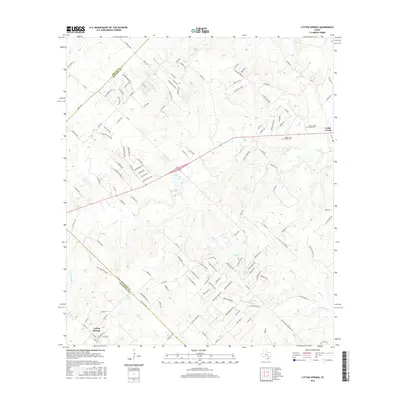
2016 Map of Lytton Springs
USGS Topo · Published 2016About this map
Lytton Springs and Cedar Creek anchor this mid-2010s survey of the central Texas landscape, where the intersections of Bastrop, Travis, and Caldwell counties meet. The terrain is defined by a dense network of tributaries including Maha Cr, Alum Cr, and the namesake Lytton Springs Cr. Genealogists will find particular value in the documentation of the Upper Cedar Creek Cem and Lower Cedar Creek Cem, situated near the eastern edge of the sheet. The landscape is heavily dissected by rural routes and residential roads like FM 812 and Mesa Dr, illustrating the contemporary suburban-rural transition in this region. Water features such as Trigg Lake and Little Alum Cr provide clear markers for property research and land-use studies, while the county boundaries offer a precise look at jurisdictional divisions south of the Austin metropolitan area.
Find a feature on this map
131 named features on this map. Tap any name to fly to it.
Don’t see what you’re looking for? This feature index may not catch every label — zoom into the map to look around manually.
Map Details
Editions of this 2016 Lytton Springs Map
This is the sole edition of this map. No revisions or reprints were ever made.
Other maps of this area

1885 · Bastrop
USGS Topo · 1:125,000

1893 · Bastrop
USGS Topo · 1:125,000

1896 · Austin
USGS Topo · 1:125,000

1897 · Austin
USGS Topo · 1:125,000

1901 · Flatonia
USGS Topo · 1:125,000

1904 · Bastrop
USGS Topo · 1:125,000

1910 · Austin
USGS Topo · 1:125,000

1911 · San Marcos
USGS Topo · 1:125,000

1919 · San Marcos
USGS Topo · 1:125,000

1930 · Lockhart
USGS Topo · 1:62,500