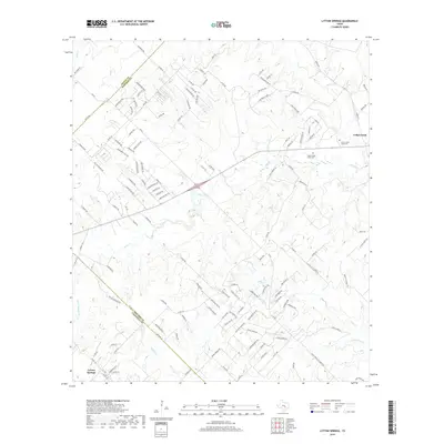
2019 Map of Lytton Springs
USGS Topo · Published 2019About this map
Lytton Springs and Cedar Creek anchor this central Texas landscape, where the terrain transitions across the Travis and Bastrop County lines. The area is defined by a dense network of watercourses, including Maha Creek, Alum Creek, and the headwaters of Lytton Creek. This 2019 survey shows a landscape increasingly subdivided by rural residential development, with numerous named lanes and loops like Elm Forest Loop and Thousand Oaks Drive branching off FM 812. For local historians and genealogists, the map identifies significant local landmarks such as Upper Cedar Creek Cemetery and Lower Cedar Creek Cemetery, which serve as vital physical links to the early families of this region. The presence of Trigg Lake and the branching tributaries of Cedar Creek illustrate the natural drainage patterns that have historically shaped the agricultural and settlement footprints of this tri-county area.
Find a feature on this map
129 named features on this map. Tap any name to fly to it.
Don’t see what you’re looking for? This feature index may not catch every label — zoom into the map to look around manually.
Map Details
Editions of this 2019 Lytton Springs Map
This is the sole edition of this map. No revisions or reprints were ever made.
Other maps of this area

1885 · Bastrop
USGS Topo · 1:125,000

1893 · Bastrop
USGS Topo · 1:125,000

1896 · Austin
USGS Topo · 1:125,000

1897 · Austin
USGS Topo · 1:125,000

1901 · Flatonia
USGS Topo · 1:125,000

1904 · Bastrop
USGS Topo · 1:125,000

1910 · Austin
USGS Topo · 1:125,000

1911 · San Marcos
USGS Topo · 1:125,000

1919 · San Marcos
USGS Topo · 1:125,000

1930 · Lockhart
USGS Topo · 1:62,500