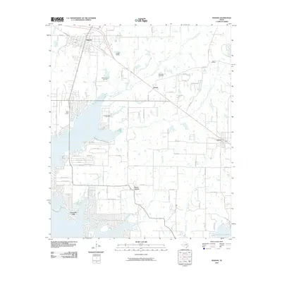
2010 Map of Mabank
USGS Topo · Published 2010About this map
Mabank sits at the northern edge of this West Texas landscape, serving as a hub for the surrounding rural communities of Pauline and Eustace. The geography is defined by the sprawling reach of the Cedar Creek Reservoir, which shapes the southwestern corner of the quadrangle near Enchanted Oaks. This man-made water body dominates the local hydrology, drawing in smaller tributaries like Cedar Branch and Spring Branch.
Find a feature on this map
72 named features on this map. Tap any name to fly to it.
Don’t see what you’re looking for? This feature index may not catch every label — zoom into the map to look around manually.
Map Details
Editions of this 2010 Mabank Map
This is the sole edition of this map. No revisions or reprints were ever made.
Other maps of this area

1920 · Kemp
USGS Topo · 1:62,500

1948 · Martins Mill
USGS Topo · 1:62,500

1949 · Martins Mill
USGS Topo · 1:62,500

1949 · Athens
USGS Topo · 1:62,500

1950 · Athens
USGS Topo · 1:62,500

1954 · Dallas
USGS Topo · 1:250,000

1956 · Tyler
USGS Topo · 1:250,000

1957 · Kemp
USGS Topo · 1:62,500

1958 · Dallas
USGS Topo · 1:250,000

1960 · Tool
USGS Topo · 1:24,000