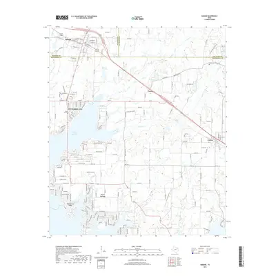
2019 Map of Mabank
USGS Topo · Published 2019About this map
Cedar Creek Reservoir dominates the western half of this landscape, its complex shoreline defining the residential growth of Gun Barrel City and Enchanted Oaks. Further north, the city of Mabank sits at the tri-county junction of Kaufman, Henderson, and Van Zandt counties, serving as a historic hub for the surrounding agricultural prairie. The map details a transition from the dense street grids and waterfront developments of the lake area to the more dispersed rural settlements like Pauline and Eustace to the east.
Find a feature on this map
128 named features on this map. Tap any name to fly to it.
Don’t see what you’re looking for? This feature index may not catch every label — zoom into the map to look around manually.
Map Details
Editions of this 2019 Mabank Map
This is the sole edition of this map. No revisions or reprints were ever made.
Other maps of this area

1920 · Kemp
USGS Topo · 1:62,500

1948 · Martins Mill
USGS Topo · 1:62,500

1949 · Martins Mill
USGS Topo · 1:62,500

1949 · Athens
USGS Topo · 1:62,500

1950 · Athens
USGS Topo · 1:62,500

1954 · Dallas
USGS Topo · 1:250,000

1956 · Tyler
USGS Topo · 1:250,000

1957 · Kemp
USGS Topo · 1:62,500

1958 · Dallas
USGS Topo · 1:250,000

1960 · Tool
USGS Topo · 1:24,000