2022 Map of Mabank
USGS Topo · Published 2022About this map
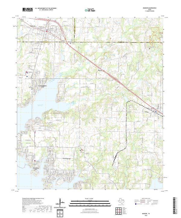
The boundary between Kaufman, Henderson, and Van Zandt counties converges near Mabank, a region defined by its complex shoreline and residential expansion around the Cedar Creek Reservoir. The map illustrates the contemporary layout of lakeside communities including Gun Barrel City, Enchanted Oaks, and Payne Springs, where modern subdivision street grids like Cottage Row and Champion Rd meet the older rural framework. Local history is preserved in several family and community burial grounds, such as Goshen Cem and the Mason Ranch Cem. Away from the reservoir, the terrain is drained by a network of creeks including N Twin Cr and S Twin Cr, which feed into larger bodies like Mabank City Lake and Abernathy Lake. The survey also documents the path of Bus 175 as it connects the primary settlements of the area.
Find a feature on this map
91 named features on this map. Tap any name to fly to it.
Don’t see what you’re looking for? This feature index may not catch every label — zoom into the map to look around manually.
Map Details
Editions of this 2022 Mabank Map
This is the sole edition of this map. No revisions or reprints were ever made.