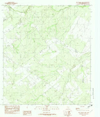
1982 Map of Mac Donald Lake
USGS Topo · Published 1982About this map
MacDonald Lake and the meandering Nueces River dominate this South Texas landscape in the early 1980s. The terrain is defined by a network of drainage features typical of the brush country, including Soldier Slough and the south-flowing Moro Creek. In the eastern portion of the quadrangle, Appurceon Creek cuts through the low-lying plains. This provisional survey captures the area’s hydrological layout before significant modern development, showing the subtle elevation changes and water management features critical for land use in Dimmit County. The map provides a foundational record of the water bodies and ephemeral streams that have long dictated ranching and land boundaries in this part of the state.
Find a feature on this map
5 named features on this map. Tap any name to fly to it.
Don’t see what you’re looking for? This feature index may not catch every label — zoom into the map to look around manually.
Map Details
Editions of this 1982 Mac Donald Lake Map
This is the sole edition of this map. No revisions or reprints were ever made.
Other maps of this area

1925 · San Roque Lake 1-a
USGS Topo · 1:48,000

1929 · Cotulla
USGS Topo · 1:125,000

1932 · Valley Wells
USGS Topo · 1:62,500

1939 · Carrizo Springs
USGS Topo · 1:62,500

1939 · Big Wells
USGS Topo · 1:62,500

1940 · Asherton
USGS Topo · 1:62,500

1940 · Catarina
USGS Topo · 1:62,500

1953 · Crystal City
USGS Topo · 1:250,000

1955 · Crystal City
USGS Topo · 1:250,000

1961 · Crystal City
USGS Topo · 1:250,000