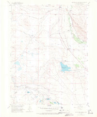
1955 Map of Mac Farlane Reservoir
USGS Topo · Published 1967About this map
The Illinois River corridor in Jackson County defines a landscape of high-altitude ranching and water management. Scattered family homesteads including the Allard Ranch, Anderson Ranch, and Curtis Ranch appear throughout the valley, illustrating the isolated nature of North Park cattle ranching in the mid-1950s. The presence of the Larand School (Abandoned) serves as a poignant marker of a shifting rural population.
Find a feature on this map
24 named features on this map. Tap any name to fly to it.
Don’t see what you’re looking for? This feature index may not catch every label — zoom into the map to look around manually.
Map Details
Editions of this 1955 Mac Farlane Reservoir Map
5 editions found
Other maps of this area

1954 · Craig
USGS Topo · 1:250,000

1955 · Delaney Butte
USGS Topo · 1:24,000

1955 · Coalmont
USGS Topo · 1:24,000

1955 · Owl Ridge
USGS Topo · 1:24,000

1955 · Gould NW
USGS Topo · 1:24,000

1955 · Walden
USGS Topo · 1:24,000

1955 · Mac Farlane Reservoir
USGS Topo · 1:24,000

1955 · Walden
USGS Topo · 1:62,500

1956 · Spicer Peak
USGS Topo · 1:24,000

1956 · Buffalo Peak
USGS Topo · 1:24,000