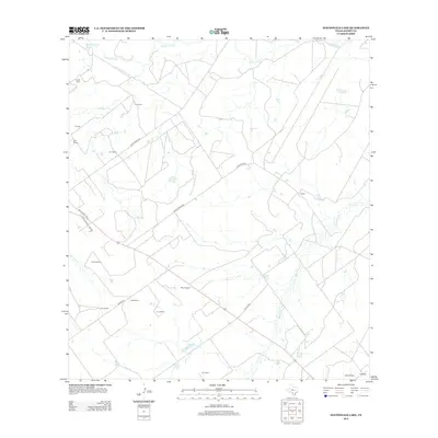
2013 Map of MacDonald Lake
USGS Topo · Published 2013About this map
MacDonald Lake and the winding course of the Nueces River anchor this rural landscape in Dimmit County. The terrain is defined by a network of drainage features like Soldier Slough, El Moro Cr, and Appurceon Cr, illustrating the hydrology of South Texas. A distinct pattern of land ownership and naming is evident throughout the quadrangle, with numerous small holdings and rural properties identified by individual names such as Eardly Farm, G B Smith, Carl Ellington, and Mike Howard. These labels offer a detailed look at the local genealogy and land use in the early 21st century. The map also traces significant local thoroughfares, including Ranch Road 190 and Ranch Road 2522, which connect these dispersed rural residences and agricultural sites across the scrubland and river bottoms.
Find a feature on this map
26 named features on this map. Tap any name to fly to it.
Don’t see what you’re looking for? This feature index may not catch every label — zoom into the map to look around manually.
Map Details
Editions of this 2013 MacDonald Lake Map
This is the sole edition of this map. No revisions or reprints were ever made.
Other maps of this area

1925 · San Roque Lake 1-a
USGS Topo · 1:48,000

1929 · Cotulla
USGS Topo · 1:125,000

1932 · Valley Wells
USGS Topo · 1:62,500

1939 · Carrizo Springs
USGS Topo · 1:62,500

1939 · Big Wells
USGS Topo · 1:62,500

1940 · Asherton
USGS Topo · 1:62,500

1940 · Catarina
USGS Topo · 1:62,500

1953 · Crystal City
USGS Topo · 1:250,000

1955 · Crystal City
USGS Topo · 1:250,000

1961 · Crystal City
USGS Topo · 1:250,000