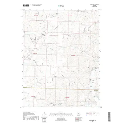
2017 Map of Macks Creek
USGS Topo · Published 2017About this map
Macks Creek serves as the primary settlement in this Ozark landscape, situated along the winding route of Macks Creek. The terrain is defined by a dense network of hollows and bluffs, particularly as the land descends toward the Niangua River in the southeast. This 2017 survey reveals a complex system of county roads and family-named landmarks that speak to the long-standing rural character of the region. Significant relief is found in the Niangua Hills, while numerous prominent riverfront features like Pikes Peak Bluff and Sugarcamp Bluff dominate the river's path.
Find a feature on this map
109 named features on this map. Tap any name to fly to it.
Don’t see what you’re looking for? This feature index may not catch every label — zoom into the map to look around manually.
Map Details
Editions of this 2017 Macks Creek Map
This is the sole edition of this map. No revisions or reprints were ever made.
Other maps of this area

1884 · Bolivar
USGS Topo · 1:125,000

1887 · Warsaw
USGS Topo · 1:125,000

1888 · Versailles
USGS Topo · 1:125,000

1892 · Bolivar
USGS Topo · 1:125,000

1893 · Versailles
USGS Topo · 1:125,000

1894 · Warsaw
USGS Topo · 1:125,000

1934 · Macks Creek
USGS Topo · 1:48,000

1934 · Green Bay Terrace
USGS Topo · 1:24,000

1935 · Barnumton
USGS Topo · 1:24,000

1939 · Macks Creek
USGS Topo · 1:62,500