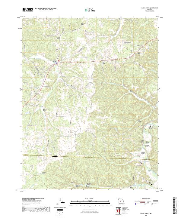
2021 Map of Macks Creek
USGS Topo · Published 2021About this map
The Niangua River winds through a landscape of deep hollows and prominent bluffs in this 2021 survey of the Missouri Ozarks. Centered on the settlement of Macks Creek, the map details a region defined by its complex topography, where the Niangua Hills rise above numerous drainage systems including Macks Cr, Jacks Cr, and Broadus Br. The terrain is marked by descriptive landmarks such as Sugarcamp Bluff, Chapel Bluff, and Pikes Peak Bluff, highlighting the significant vertical relief near the Camden and Dallas county line. For genealogists and local historians, the sheet identifies several small family and community burial sites, including the Wiley Gott Cem, Berry Cem, and Winters Cem, as well as the southern settlement of Celt. This modern data shows how contemporary roads like State Hwy W and State Rd J follow the natural ridges between hollows like Bannister Hollow and Cave Hollow.
Find a feature on this map
104 named features on this map. Tap any name to fly to it.
Don’t see what you’re looking for? This feature index may not catch every label — zoom into the map to look around manually.
Map Details
Editions of this 2021 Macks Creek Map
This is the sole edition of this map. No revisions or reprints were ever made.
Other maps of this area

1884 · Bolivar
USGS Topo · 1:125,000

1887 · Warsaw
USGS Topo · 1:125,000

1888 · Versailles
USGS Topo · 1:125,000

1892 · Bolivar
USGS Topo · 1:125,000

1893 · Versailles
USGS Topo · 1:125,000

1894 · Warsaw
USGS Topo · 1:125,000

1934 · Macks Creek
USGS Topo · 1:48,000

1934 · Green Bay Terrace
USGS Topo · 1:24,000

1935 · Barnumton
USGS Topo · 1:24,000

1939 · Macks Creek
USGS Topo · 1:62,500