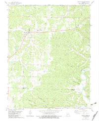
1982 Map of Macks Creek
USGS Topo · Published 1983About this map
The settlement of Macks Creek serves as the focal point for this region of the Ozarks during the early 1980s, where the landscape is defined by a dense network of steep drainages and hollows. The Niangua River winds through the southeastern corner, flanked by dramatic vertical features such as Pikes Peak Bluff and Sugarcamp Bluff. This survey captures the rural character of the area where Camden County and Dallas County meet, showing small community centers like Celt and religious landmarks like Mission Ridge Ch. Local history and genealogy are preserved in the locations of several family-named burial sites, including the Wiley Gott Cem, Winters Cem, and Berry Cem. The map illustrates a traditional Missouri hill-country settlement pattern, with homesteads and churches positioned along the ridges above named valleys like Big Spring Hollow and Sugarcamp Hollow.
Find a feature on this map
45 named features on this map. Tap any name to fly to it.
Don’t see what you’re looking for? This feature index may not catch every label — zoom into the map to look around manually.
Map Details
Editions of this 1982 Macks Creek Map
This is the sole edition of this map. No revisions or reprints were ever made.
Other maps of this area

1884 · Bolivar
USGS Topo · 1:125,000

1887 · Warsaw
USGS Topo · 1:125,000

1888 · Versailles
USGS Topo · 1:125,000

1892 · Bolivar
USGS Topo · 1:125,000

1893 · Versailles
USGS Topo · 1:125,000

1894 · Warsaw
USGS Topo · 1:125,000

1934 · Macks Creek
USGS Topo · 1:48,000

1934 · Green Bay Terrace
USGS Topo · 1:24,000

1935 · Barnumton
USGS Topo · 1:24,000

1939 · Macks Creek
USGS Topo · 1:62,500