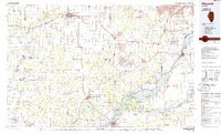
1985 Map of Macomb
USGS Topo · Published 1985About this map
The Lamoine River and Spoon River drain the rolling plains of West Central Illinois in this 1985 survey, which highlights a landscape shaped by both agriculture and significant conservation efforts. At the heart of the region, the city of Macomb serves as a major hub, home to Western Illinois University and the Smith Airport. The map documents a diverse mix of land uses, from the industrial activity of a Strip Mine to the preservation of Indigenous history at Dickson Mounds State Park.
Find a feature on this map
176 named features on this map. Tap any name to fly to it.
Don’t see what you’re looking for? This feature index may not catch every label — zoom into the map to look around manually.
Map Details
Editions of this 1985 Macomb Map
This is the sole edition of this map. No revisions or reprints were ever made.
Other maps of this area

1909 · Tallula
USGS Topo · 1:62,500

1912 · Canton
USGS Topo · 1:62,500

1912 · Macomb
USGS Topo · 1:62,500

1913 · Colchester
USGS Topo · 1:62,500

1914 · Macomb
USGS Topo · 1:62,500

1915 · Avon
USGS Topo · 1:62,500

1916 · Good Hope
USGS Topo · 1:62,500

1918 · Vermont
USGS Topo · 1:62,500

1918 · La Harpe
USGS Topo · 1:62,500

1918 · Good Hope
USGS Topo · 1:62,500