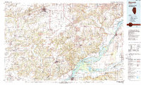
1989 Map of Macomb
USGS Topo · Published 1989About this map
The Macomb region in West Central Illinois is defined by the significant confluence of river systems and the late-century expansion of conservation lands. This 1989 U.S. Geological Survey compilation reveals a complex network of wetlands and backwaters along the Illinois River, where the Sanganois State Conservation Area and Chautauqua National Wildlife Refuge preserve vast stretches of aquatic habitat. The mapping of Lake Chautauqua and Anderson Lake highlights a landscape where human utility and natural preservation coexist, bounded by the active industrial corridors of the Burlington Northern RR.
Find a feature on this map
158 named features on this map. Tap any name to fly to it.
Don’t see what you’re looking for? This feature index may not catch every label — zoom into the map to look around manually.
Map Details
Editions of this 1989 Macomb Map
This is the sole edition of this map. No revisions or reprints were ever made.
Other maps of this area

1909 · Tallula
USGS Topo · 1:62,500

1912 · Canton
USGS Topo · 1:62,500

1912 · Macomb
USGS Topo · 1:62,500

1913 · Colchester
USGS Topo · 1:62,500

1914 · Macomb
USGS Topo · 1:62,500

1915 · Avon
USGS Topo · 1:62,500

1916 · Good Hope
USGS Topo · 1:62,500

1918 · Vermont
USGS Topo · 1:62,500

1918 · La Harpe
USGS Topo · 1:62,500

1918 · Good Hope
USGS Topo · 1:62,500