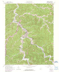
1962 Map of Madison
USGS Topo · Published 1989About this map
Madison and neighboring Danville serve as the hub of this West Virginia landscape, situated along the winding banks of the Little Chesapeake and Ohio and the primary Chesapeake and Ohio rail lines. The topography is defined by the tight valleys of Scott, Washington, and Crook districts, where local life is oriented around the waterways and rail spurs that serviced the regional extractive industries. A sprawling Gas Field covers much of the northwestern terrain, while a Strip Mine appears on the eastern ridges near Peytona. Genealogists will find a high density of family burial grounds, including Foster Cem, Miller Cem, and the Vandaleinde Cem, alongside landmarks like the Rock Creek Sch and the Drive-in Theater near Rock Creek. These details reflect a mid-century Appalachian community defined by its coal and gas economy and a deeply rooted network of valley settlements.
Find a feature on this map
85 named features on this map. Tap any name to fly to it.
Don’t see what you’re looking for? This feature index may not catch every label — zoom into the map to look around manually.
Map Details
Editions of this 1962 Madison Map
4 editions found
Other maps of this area

1891 · Oceana
USGS Topo · 1:125,000

1893 · Oceana
USGS Topo · 1:125,000

1898 · Oceana
USGS Topo · 1:125,000

1899 · Charleston
USGS Topo · 1:125,000

1909 · Peytona
USGS Topo · 1:48,000

1910 · Bald Knob
USGS Topo · 1:48,000

1911 · Peytona
USGS Topo · 1:62,500

1911 · Madison
USGS Topo · 1:62,500

1912 · Bald Knob
USGS Topo · 1:62,500

1913 · Logan
USGS Topo · 1:62,500